

About WeMap
About WeMap
Waterway WeMap is a paid software product developed by Chengdu Waterway Notes Information Technology Co., Ltd. It comes in different versions and licensing fee structures and is one of the common domestic GIS software platforms.
Waterway WeMap provides rich geographic information data for mainland China, including detailed urban building data for some major cities.
Featuring an all-in-one user interface, software users can operate within a single interface to download the topographic maps and building documents required for modeling. After downloading, users can obtain detailed and abundant geographic data documents for subsequent mapping work, or import them into software like Wireless Insite for modeling purposes.
Functional Highlights of WeMap
Map downloading is one of the primary functions of the product. It can download various GIS data including high-definition satellite imagery, historical imagery, elevation DEM, POIs, building footprints, administrative divisions, and township boundaries.
High-Definition Satellite Imagery Download
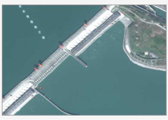
WeMap provides high-quality satellite imagery. Users can select an area of interest, choose the imagery source, set the projection method, and download high-definition satellite images.
WeMap provides users with high-quality historical image. Users can search along a timeline and download satellite images from different time points for their area of interest.
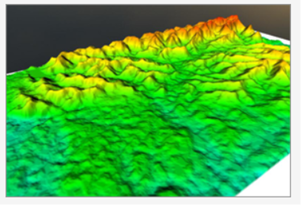
WeMap is a lightweight GIS product that integrates map downloading and GIS functions. Compared to the previous 3.X version of the Universal Map Downloader, it offers richer map data and more professional GIS functions. Users can download 3D topographic maps of areas of interest for various modeling, simulation, or research purposes.
Recently, the map data underwent a significant upgrade. All offline data has been integrated into the new version, WeMap 4.0 (build 8907). This mainly includes global imagery from levels 2 to 19 (equivalent to zoom levels 2-18) and national (China) imagery from levels 2 to 20 (equivalent to zoom levels 1-19)
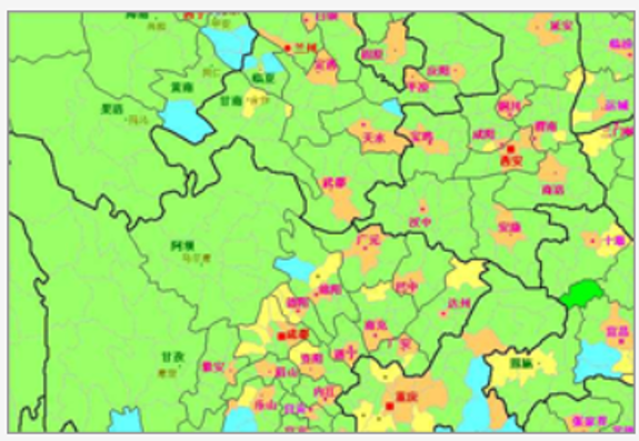
Users can download national provincial and municipal administrative division data through WeMap. This data has undergone topological processing, ensuring the boundary points of provincial and municipal administrative divisions align perfectly.
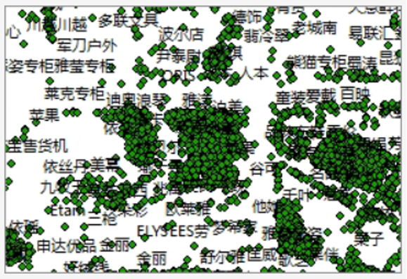
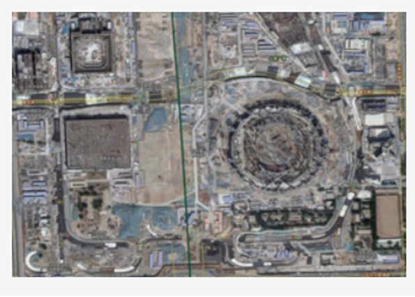
POI is the abbreviation for "Point of Interest".
In a Geographic Information System, a POI can be a restaurant, a bus stop, a landmark building, a school, etc.
Users can also simply think of them as place names. For example, in the image, all place names represented by icons are POIs, such as the Palace Museum, Jingshan Park, Xiehe Hospital East Campus, Beijing Marriott Hotel Wangfujing, and the National Art Museum of China.
To better fulfill the mission of "Providing you with abundant map data and professional GIS services," WeMap has released the "Waterway Notes National POI 1.0" dataset containing over 118 million entries. This data can be downloaded within the software.
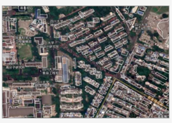
WeMap users can download building outline vector data for dozens of medium and large cities and export it in several commonly used CAD formats (DXF, SHP, etc.). In addition to building vector data, it also includes vector models for water bodies like rivers. Users can use these CAD documents along with elevation geographic data to create more detailed and realistic urban scene environment models.
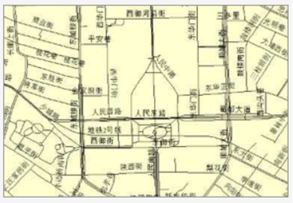
In addition to providing topographic maps and building outlines, users of WeMap can also download vector road network maps for these domestic medium and large cities. Combined with topographic maps and building outlines, they more faithfully represent the appearance of modern cities and can be used to create more realistic urban scenes for simulations.

Waterway MicroMap supports methods for loading satellite imagery and elevation DEM data offline into the Cesium open-source 3D globe.